Monday, July 15

Bigu Gumba--Tashi Gyachhal Nunnery

It's my pleasure to welcome you in the new episode of "Beauty and Perfection: The Gaurishanker Himalayas". In my last post, I had described the Kalinchok Area through the multiple arenas. Since Kalinchok and Bigu are located in similar land setting and are adjacent to each other, I am writing about these in a row so that my readers won't get confused. And, I'm also thinking of being less wordy and more pictorial. Hope you will enjoy a pictorial tour de Bigu Gumba :D
Entrance Gate of the Bigu Gumpa
Stupa encountered immediately after entering into the Bigu Gumpa Complex

View of the Bigu Gumpa with Stupa
Frontal View of the Bigu Gumpa
Bigu Gumba, also called Tashi Gyachhal Nunnery is probably the oldest nunnery of Dolakha with a century long history. It is situated in Bigu VDC of Northern Dolakha at an altitude of around 2500 meter from sea level. Sherpa are the major inhabitants of the area. So, one can experience the typical Sherpa culture, and also accompanied by the Thangmi (Thami).
Way of welcoming in Sherpa Culture. The scarf in hand is called 'Khada',
the sacred cloths with Buddhist mantras on it
This nunnery teaches the nuns, who come to nunnery as their own wish. Recently, with an increasing necessity of modern educational system, the Nunnery also started teaching the regular school classes up to grade 5 with specialization on Tibetan script and Buddhist philosophy.
Nuns leaving for their Hostels after completing morning prayer's in the Gumpa
The Bigu Gumpa Complex

Wednesday, May 22

Beauty and Perfection: The Gaurishanker Himalayas


There are several folds of experiences to pour on this blog. Whenever I got spare time, even few hours, I always wander around the laps of Himalayas. It was the summer of 2007 when I had my first formal trek into the high altitude landscapes. Since then, I had travelled extensively mainly for research, and few for fun and recreation. Increasing the number of travels, number of stories increases. Only few stories are stored in notebooks, however, all are safely stored in mental chip and still fresh and complete!

When I started this blog, I thought of presenting my travelogue only through an ecological point of view. However later I realized that presenting just an ecological facet, without their host landscapes and socio-cultural values would never be a complete travelogue. You might have noticed these flavors in "Mustang" posts as well, though I have not been able to fully incorporate the culture and its significance to Nature. You know I am not a professional writer, and am gradually learning the literate styles of writing. Therefore, I am thinking of increasing the number of photographs in my posts for the greater understanding out of my inattentive writings! I believe that 'a picture worth's a thousand words', and you would love to see the scenic beauty in and around the Himalayas.
Closeup view of Gaurishanker Himalaya (a part of Rolwaling Himalayan Range)

Let's begin a brand new session of this blog (actually I am posting this post after almost 2 years!) with a new piece of beautiful geography of Central Himalayas. I am delighted to introduce you an entirely new and untouched (by the nasty modernism) destination - The Kalinchok-Bigu Gumba Area of Northern Dolakha. I will be presenting these landscapes into two different posts; The Kalinchok and The Bigu Gumba (Monastery).

A. Kalinchok Area
Locality:
Charikot, Dolakha - a beautiful town at the top of midhill at an altitude of 1980 meter from sea level on the lap of Gaurishanker Himalayas is 135 Km North-East from the capital city, Kathmandu. Though it's a boarder of subtropical and temperate climatic zones, it extends further to meet the high Himalayan alpine climate in Kalinchok Peak, which is situated in an altitude of 3750 m. Political division considers this peak as a reference point to separate two districts Sindhupalchok and Dolakha. It takes almost a day hike, 6-7 hours to be precise, to reach the peak. If you can't walk, please do not worry. Bus can drive you to the foot of the Kalinchok (Kuree) from where walking just an hour is enough to summit Kalinchok peak. There are several Hotels and Guest Houses at Kuree, so do not worry about the accommodation. You can be choosy and enjoy a range of hotels, cheap motels to expensive resort. 
A view of Charikot, Dolakha and the Kalinchok Area

Kalinchok Area during snowfall; captured on 17 February, 2013
Sanctity
Imagine a mountain peak with just a few square meters at the top but have a highly respectable and historic temple (called Kalinchok Temple) from where anyone can have 360 degree panoramic view of Himalayas and its foot hills. Being a temple at the peak with small space only is not the matter of surprise, however having a small pond (Kunda) in the center of temple with water throughout the year is really a center of attraction to everyone. Nobody adds water to that pond rather every religious pilgrim extracts water believing that as sacred water; splash of which purify and swipe away all your misdeeds. 
Holy Kalinchok Temple Complex
Holy Kalinchok Temple Complex, with a view of Gaurishanker Himalaya in background
Religious History:
It is believed that Goddess Vagawoti had emerged from the Kunda. A fairy tale relates the appearance of Goddess Vagawoti in Kali Avatar in ancient time was to kill the demons called Sunda, Munda and Mahisasur. According to the fairy tale, these demons were giant and deadly, and destroying human civilization and killing everyone down in the villages. The Goddess Vagawoti took the Kali Avatar to fight against them for the protection of Human beings. The fairy tale further explains that, when Kali came down the Kalinchok peak at Kuree (a small flat land at the bottom of peak), a troop of demons attacked her. The fight lasted for few days and finally Kali killed them all. During the time of war the blood of demons, due to massive massacre by Kali, got a form of Small River to flow down the Valley. Local people relates this with a small river (stream) flowing through Kuree Valley. Please see the picture below to generalize how Kuree Valley looks like when captured from Kalinchok Peak (Temple): 


A view of Kuree as seen form the Kalinchok Temple
Diversity
I had been there quite a few times and every visits made were in different seasons. So I was lucky to experience freezing cold to mild temperature, dry rough topographic pastures to lovely green pastures full of natural herbs to decorate landscapes with different flower colors, pleasant view of scenic beauty sculptured by the blooming rhododendrons and the impressive snowfall. Anyone can guess how difficult it is to summarize the delightful feelings within the words. So I do not want to limit you in words rather would like to leave you free for the lovely imaginations. Please have a look at the pictures capturing the different aspects of Kalinchok:
A view of Kalinchok area decorated by the Rhododendrons
Kalinchok forest Landscape captured with Rolwaling Himalayan Range 

 A Rhododendron tree at full blooming stage
An interior view of Kalinchok forest 
Peoples living around Kalinchok Area
Ecology
As a natural science scholar, the two weeks I spent, along with Mr. Janardhan Mainali - Ecologist cum GIS Analyst, during the summer of 2010 remained highly valuable. We had been able to record 241 plant species from the area; which includes small delicate herbs to tall giant pine trees. It is interesting to note that we have recorded 6 different species of Rhododendrons from the forest of Kalinchok. Of these, few species for example, Rhododendron arboreum, R. campanulatum and R. barbatum found to have few thick bands presenting as a dominant species of different mountain forest types. Especially, R. campanulatum is the one which constitutes pure stands in different aspects to develop a separate forest type. This is the same species which decorates Himalayan landscapes in spring when it is in full bloom with different beautiful colors. See few glimpses below: 

Rhododendron arboreum bud

Rhododendron campanulatum bud

A white flowered Rhododendron

Rhododendron campanulatum 

A whitish-red flowered Rhododendron arboreum
Scenic Beauty
As mentioned earlier, we can have 360 degree view from the top of Kalinchok. We can easily have a view of Rolwaling Himalayan Range and Ganesh Himalayas Range, Sumeru prvat and some Tibetan mountains towards the Northern and Eastern direction. A beautiful vista of valleys and series of mid hill landscapes can be observed towards Southern and Western direction. Local peoples said that one can easily see Dharahara at Kathmandu from the top. However this view is rare these days due to the dense haze layers in environment. This can be a good example of regional effect of Asian Brown Air and Pollution of Kathmandu Valley.
Mt. Sumeru Parvat; a holy mountain
A South-East View from Kalinchok Area
A North-West View from Kalinchok
A Southern View from Kalinchok 
View of Sun-Set as seen from Kalinchok Area
Responsibility
The forest of Kalinchok is experiencing severe pressure these days due to unsustainable timber harvesting and illegal trade. Similarly the forests of R. campanulatum, the landscape decorator, are under pressure due to their excessive use as a fuel wood in the hotels at Kuree. The uncontrolled solid waste pollution in one hand threatening local flora and fauna, and on the other hand ruining the natural beauty of the landscapes. 
Destruction in Kalinchok Area
Forest encroachment in Kalinchok Area
 So, we should seriously think about the problem and act against pollution, otherwise we may lose several natural beauties in days to come and won't be left anything to handover to our future generations. Government of Nepal must initiate conservation and awareness campaigns immediately. The hotels running in Kuree should also be responsible to keep the beauty of Kalinchok intact. I also urge you to be a responsible CITIZEN/VISITOR/TOURIST.
Dependency on Forest Resources in Kalinchok Area
Primula : A FLOWER APPEALING FOR THE CONSERVATION OF ITS HABITAT

LETS JOIN OUR HANDS FOR THE 
BIODIVERSITY CONSERVATION !!!


Wednesday, May 8

Recommence, Apology and the COMMITMENT

I have really been a bad blogger. Its been complete one year, 10 months and 25 days since my last post. Initially, I had to focus on my Master's Thesis during my off-Office hours. Later this year, the additional official responsibilities made me so hectic that I couldn't write any blog posts, although I really wanted to have some of those.

I apologies for this inconvenience. I know I have really dissapointed all my blog followers and readers. Just an apology can't compensate the bitterness that arose out of this foolishness. However, I strongly believe that I have many genuinely caring and affectionate readers like you! I am fortunate for this privilege.

Now, I would like to assure and commit that I will be updating the blog on regular basis. Please take it as a humble promise. I have a lot to share with you !

Thank you all.

Rabindra

Monday, June 13

A Travel beyond the Himalayas: Mustang #4!

ofqf lxdfn kfl/sf] M d':tf¨ efu —­$

Ranipauwa, the only town of Muktinath, is about 45 minutes walk from the Jharkot. The trail, along with the land settings looks perfect: wide enough and neither plain nor steeply uphill. The landscape is rather mild but with very rough terrain.  No greenery around. That may be because of the season. People said it gets a bit greener during summer though there are no trees. Only few adaptive scrubs and herbaceous species grow and bloom when the area receives rain. Rainfall is very scanty. Mustang is one of those areas which receive extremely low rainfall. As I already mentioned on previous post, this is mainly due to the monsoon shaded by Annapurna-Dhaulagiri Massif. One of greatest naturalists, Adam Stainton classified this valley as Inner Himalayan Valley. In his book ‘The Forest of Nepal’, he mentioned that Mustang has similar vegetation to Tibet because of the physiographic and climatic similarity. The only few woody species found modifies their habit into compact and dwarf spiny form. Such life form is called Cushion, which is the best life form to cope the environmental (especially extreme radiation, aridity, temperature and wind) as well as biotic (browsing by Yaks, Naks, Chauries, Horses, Sheeps and Goats etc.) severity. These cushion species are an integral components of trans-Himalayan vegetation.

Landscape of Mustang with Mt. Dhaulagiri on distance
 As I approached Ranipauwa, I checked quite a few hotels but couldn’t see my research colleague. I didn’t have any alternative, so opted to go find him around Muktinath Temple Complex. 
Ranipauwa Town, Muktinath Mustang
 It takes about 15 minutes from Ranipauwa to Muktinath temple. The trail is somewhat uphill but not really hard. I was alone and climbing up towards main gate of the temple. Because of being in high altitude area it was hard to walk, and had to drink water quite frequently with sufficient rest. The souvenir shops on both side of trail were trying to persuade me to buy their stuffs. They were getting excited when I started looking at their shops. But their excitement didn’t last long because I only had bare promises. As of many visitors, who just see their souvenirs, I also didn’t buy. I looked at their shop because there were some really interesting items like ammonites, very thick and attractive woolen scarf, socks etc. They jack up price quite interestingly. I asked a lady who had the largest shop on right side of trail, about the way of fixing prices and percentage they save as profit. 
The souvenir shops and Close up view of the town.
Firstly she denied talking but later after a long conversation on other aspects of her life, she revealed that they fix price observing the costumer. She told that she sometimes hike up the price even up to 200%. It largely based on how much time costumer spent looking her stuffs. For those who looks souvenirs for longer, play with those and gets smaller items, she charges more money. But, that visitor who goes for quick selection gets quite a good discount. However, she argued that she has never charged inexplicably. It is interesting to note that all the souvenir shops were ran by women. Further, they are not so aware about the skin problems they might face because of the intense solar radiation and the dust wind blows, and strikes their skin every seconds. Even if they know they can’t quite the shop – one of the major sources of income for their family to sustain and to educate their kids. Though they are quite adaptive to physical surrounding, they may not be able to tolerate cancer causing solar radiation! Above all they are enjoying, which is great :)
See the people looking at one of the souvenir shops. (sorry for poor quality pic.!
But I was walking slowly and taking longer than I was supposed to. I was planning to wait Gabe outside the complex because I didn’t want to visit the temple that day! It is believed that before entering into Hindu religious complexes, one should be sacred. According to mythology, it is considered to be sacred/ pure if one takes shower and changes clean clothes. Although I showered last evening and was pretty clean, I was not culturally pure because I didn’t washed my body on same day. So, as an inborn Hindu [I’m a believer and do believe on existence of God but just SINGLE. I think, The God for all religion is same (and just ONE) but the way of perceiving him are different so there are many religions around the world], I was not willing to enter into temple complex when I was (so called) impure.

The Holy Muktinath Temple, Mustang

Monday, April 18

A Travel Beyond the Himalayas: Mustang # 3!

d':tf¨ efu —­#

A view of Himalayas as seen from the Pokhara Airport


I got to capture these stunning Himalayas from Plane

hf]d;f]d} ahf/df !@ ah] xfjf ;// .
P xh'/ 3/ xfd|f] kf]v/f, cEfm} ;Dd ef5}g 3/af/ ..
(Jomsome, air blows 12.00 noon;
Hey, we are from Pokhara and still unmarried!!) 

This is a rhyme of one famous Nepali song (by Nepathya) echoing on and striking me when I was about to step down from Sita Airlines’ Twin Otter (spell?) plane for the first time in Jomsome Bazzar. As in song, it was extremely windy. The wind blowing from south to north was such a strong that it was very difficult for everyone to handle their bags and move smoothlyL. But walking along the air current was super easy and effortless!
Landed Safely :)... Jomsome Airport and Mt. Nilgiri on the background
The journey was highly remarkable for me! I had to struggle to fly. Due to the fluctuating weather flights were cancelled for two days. Even in third day weather was not so good but the captain dared to fly, and thanks GOD for safe landingJ. That was the only flight taken that day. If I would not have gotten chance to fly on that plane I would have to wait for another day. So, I must thank a guy (I’m sorry, I forget his name) from SITA Air who was highly generous to provide me room on first flight even there was a long queue of foreign tourist who were paying way more in US$ for the ticket.

See the arid landscapes of Mustang and a suspension bridge above  Kaligandaki River
Although very dry and arid, landscapes were carved in such a way that everyone could easily lost within the beauty of Mustang. And, I was super excited to travel beyond the Himalayas. The only problem I had was being late by 2 days to conduct research. My research partner Mr. Gabe Stutman (from Washington DC, USA), who was already in Muktinath temple, was counting every minute for my arrival. And, It is totally understandable that how terrible time everyone finds to wait someone not even for a couple of hours but for three days! I am sorry my friend (d]/f] ;fyL u]j dnfO{ dfkm ug'{xf];\ .) ! 

Though it was super windy I decided to leave for Jharkot where everyone was waiting me. We had a team of 8 students (4 Nepali and 4 Americans) from CNSP (Cornell Nepal Study Program) looking at four different aspects in Mustang. As a part of regular courses of CNSP our American friends were there for their research and we (Nepali students) were assisting them.

The Jharkot Village
When I got into Hotel Plazza in Jharkot around 6:00 pm I was completely exhausted. I didn’t see anything on the store but just the Fanta! Wow J I didn’t have to wait for second round to finish half liter fanta. Now I could see who were there; almost all except Paul and Gabe! I came to know that Paul is staying with Amchi and Gabe is in Ranipauwa - Muktinath.
 
Winter season; Mustang region; evening time; very tired; how would you feel if you take shower using freezing water? Though shivering with almost frozen fingers, I was feeling refreshed! Cold but clean! Great time for coffee.

See few more snaps on the way to Jharkot:

Mustang valley: Kaligandaki River gorge

Plants coping with aridity
Salix were the only trees I saw with leaves

Sunday, April 3

A Travel Beyond the Himalayas: Mustang # 2!

Major Routes:
Mustang is one of the major tourist destinations of Nepal. Many people visit the area not only to experience local culture and enjoy scenic beauty but also to understand the religious mutualism – which is being exemplified by the Holy Muktinath Temple. Thousands of National as well as foreign (mainly Indians) Hindu people visits this temple as a pilgrim. There are many things to talk about the Mythology, beliefs and other important aspects of Mustang and Muktinath Temple as well. Which I think is better if it is dealt details of each site separately. So, for now let’s starts with Major Route to Mustang in an order of shortest to Longest:-
Map showing the Route 1: the green line
 Route 1: Pokhara – Jomsome – Muktinath (the shortest one!)
Area: Mustang, Nepal
Type of tour: Eco-cultural/Pilgrimage
Difficulty: Easy
Hotel Facility: Available; Average - Standard
Trip Costs: US$50 - 150 per day per persons (foreign tourists) + Flight charge: US$ 160 - 200
NRs.1500 – NRs.3500 per day per persons (national tourists) + Flight Charge: NRs. 4000/7000
Maximum Elevation: 3850 meter average sea level
Season: Almost every season
Duration: 4 days
Day 1: Fly from Pokhara to Jomsom (15 minutes flight) and trek to Kegbeni (2 hrs.)
Day 2: Kagbeni to Muktinath (4 hrs.)
Day 3: Muktinath to Jomsom (5 hrs.)
Day 4: Fly from Jomsom to Pokhara (15 minutes flight)

Route 2: Pokhara – Beni – Tatopani – Jomsome – Muktinath
Area: Mustang, Nepal
Type of tour: Eco-cultural/Geographical/Pilgrimage
Difficulty: Medium
Hotel Facility: Available; Average - Standard
Trip Costs: US$50 - 150 per day per persons (foreign tourists) + Flight charge: US$ 80 - 100
NRs.1500 – NRs.3500 per day per persons (national tourists) + Flight Charge: NRs. 2000/3500
Maximum Elevation: 3850 meter average sea level
Season: September – October
Duration: 8 days
Day 1: Drive from Pokhara to Beni
Day 2: Beni to Tatopani
Day 3: Tatopani to Kalopani
Day 4: Kalopani to Jomsom via. Marpha (the delightful apple kingdom of Nepal)
Day 5: Jomsom to Kagbeni
Day 6: Kagbeni to Muktinath
Day 7: Muktinath to Jomsom
Day 8: Fly from Jomsom to Pokhara
Map Showing Route 2 (the green line) and Route 3 (the red + green then after): I apologies for poor quality oblique map!
Route 3: Pokhara – Ghorepani – Tatopani – Jomsome – Muktinath
Area: Mustang, Nepal
Type of tour: Eco-cultural/Pilgrimage
Difficulty: Strenuous
Hotel Facility: Available; Average - Standard
Trip Costs: US$50 - 150 per day per persons (foreign tourists) + Flight charge: US$ 80 - 100
NRs.1500 – 3500 per day per persons (national tourists) + Flight Charge: NRs. 2000/3500
Maximum Elevation: 3850 meter average sea level
Season: March – April and September – October
Duration: 10 days
Day 1: Drive from Pokhara to Birethanti
Day 2: Birethanti to Ulleri
Day 3: Ulleri to Ghorapani (to Pun Hill as well)
Day 4: Ghorapani to Tatopani
Day 5: Tatopani to Kalopani
Day 6: Kalopani to Jomsom
Day 7: Jomsom to Kagbeni
Day 8: Kagbeni to Muktinath
Day 9: Muktinath to Jomsom
Day 10: Fly from Jomsom to Pokhara

Route 4: Pokhara – Dumre (Tanahu) – Besisahar (Lamjung) – Chame – Manang – Thorang Phedi – Thorang-La – Muktinath: The Annapurna Circuit trek - longest one! This takes 2 weeks to get back to Pokhara after a complete circle, but it is still worthy to enjoy the vastness of Himalayas.
Area: Manang and Mustang, Nepal
Type of tour: Ecological – Cultural – Geographical
Difficulty: Strenuous /Tough
Hotel Facility: Available; Average - Standard
Trip Costs: US$75 - 200 per day per persons (foreign tourists) + Flight charge: US$ 80 - 100
NRs.1500 – NRs.3500 per day per persons (national tourists) + Flight Charge: NRs. 2000/3500
Maximum Elevation: 5416 meter average sea level
Temperature: Goes below freezing during Thorang-La cross
Season: March – April and September – October
Duration: 10 days
Day 1: Drive from Pokhara to Beshisahar (5 hrs.)
Day 2: Beshisahar to Bahaundanda (5.75 hrs.)
Day 3: Bahaundanda to Jagat (4.5 hrs.)
Day 4: Jagat to Dharapani (5 hrs.)
Day 5: Dharapani to Chame (4.75 hrs.)
Day 6: Chame to Pisang (4. 5 hrs.)
Day 7: Pisang to Braga/Manang (3.5/4 hrs.)
Day 8: Manang Rest day (Hike to Icelake)
Day 9: Manang to Ledar (3.5 hrs.)
Day 10: Ledar to Thorangla Phedi/High Camp (3/4.5 hrs.)
Day 11: Thorangla Phedi/High Camp to Muktinath (8 to 10 hrs.)
Day 12: Muktinath to Kagbeni via Jhong (3 hrs.)
Day 13: Kagbeni to Jomsom (2 hrs.)
Day 14: Fly from Jomsom to Pokhara (15 minutes)

Thursday, March 24

A Travel Beyond the Himalayas: Mustang # 1!

General Information
Mustang, also called the “Himal Pariko Jilla (District beyond the Himalayas)”, lies north to the gigantic Annapurna-Dhaulagiri massif. People from low land called it as “Thak Khola”; meaning – the land of Thakalis (Gurung Communities). The region represents an extension of the Tibetan Platue and characterized by extremely dry climate. The Annapurna (8091m average sea level) and Dhaulagiri (8167 m asl) screens the summer monsoon, hence the rainfall is very scarce. 
Dhaulagiri range - a major summer monsoon barrier ; as seen towards south from the Jomsom (the HQ of Mustang)
Some people named the valley as a ‘desert of the Himalayas’. But ecologically it is being characterized as an ARID zone and the flora recognized as Tibetan elements. The vegetation is of the steppe type with domination of Caragana spp., Lonicera spp., Juniperus spp., Rosa spp. etc. Tree species are limited to only Populus and Salix. Apples tree are also found booming in private orchards.
A Landscape showing Cushion forming Caragana - Lonicera vegetation and Mt. Dhaulagiri on distant
Politically, traditionally and even culturally (I think) the whole Mustang valley is divided into 2 major regions; the Upper Mustang (popularly called the Lo-Manthang) and the Lower Mustang. Kaligandaki river is the only river-system originated from Mustang. The river is famous in Hindu religion because we can find Ammonites/Shaligram (one of the various forms of Lord Bishnu - the Protector).

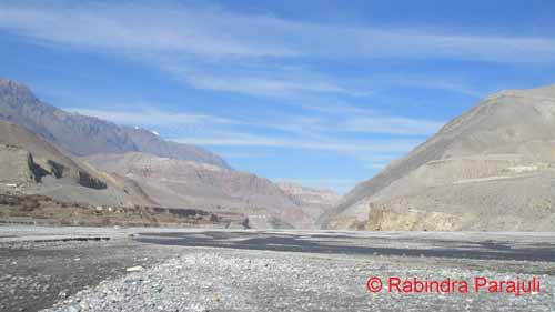
A landscape of Mustang showing the gorge carved by Kaligandaki river ; taken on 21st of November.
Lo-manthang is the northern part of the Mustang extended towards north from Kagbeni up to the border of Chinese Autonomous Region – the Tibet. The area is designated as a restricted zone by the Department of Immigration, Government of Nepal. To my knowledge, it is because the area has its particular culture/traditions, has been ruling by the local King since centuries, and also because of being an open border area with Tibet. It is mandatory to have an especial entry permit to visit Lo-Manthang. The fee is quite a bit high. One person should pay at least US$ 500 to enter the area and this works for 10days. For each extra day need to pay US$ 50/day. The Department of Immigration only issues the permit. I haven’t yet been to Upper Mustang. I would love to go and will write in detail if I get chance to visit.
Kaligandaki River and the lower part of Lo-Manthang, where we can find Ammonites easily
It is much easier to trek on the Lower Mustang. But a permit is must for foreigners. The permit provisions are as: 
Permit Procedure and Regulations:
Entry Fee (Per Person) to visit Annapurna Conservation Area (ACA):
For SAARC Nationals: Nepali Rupees 200.
For other Nationals (other than SAARC countries): Nepali Rupees 2,000.
Note:
Entrance fee not required for children less than 10 years of age.
Trekkers visiting multiple Conservation Areas will require obtaining individual Entry Permits for each Conservation Area.
Two passport size photographs are required while applying for each Entry Permit.
Terms and Conditions:
This Entry Permit is valid for single entry only and is non refundable, non-transferable. The permit holder can enter the designated places within the Conservation Area.
Person entering the Conservation Area shall abide by the National Park and Wildlife Conservation Act, 2029 B.S. (1973) and the Regulations made under this Act.
This Entry Permit must be carried during the entire trip and should be shown if concerned personnel of the Conservation Area want to check it.
Entry permits to Annapurna Conservation Area (and Manaslu Conservation Area as well) will only be issued from the following Entry Permit Counters listed below. Entry Permits will not be issued from any check posts along the trekking routes of the Conservation Areas. Therefore, all are requested to obtain an Entry Permit before entering the Conservation Areas. However, under special circumstances, Entry Permit may be issued from the check posts along the trekking route upon a payment of 100% additional charge.
Entry Permits available at the following locations:
Kathmandu: Nepal Tourism Board , Bhrikutimandap, Kathmandu (for Annapurna & Manaslu)
Opening hours Sunday to Saturday except on public holidays in Kathmandu: 9 am – 5 pm
Pokhara: Nepal Tourism Board, Tourist Service Centre, Pardi Damside (for Annapurna only)
Opening hours Sunday to Saturday except on public holidays in Pokhara: 10 am – 5 pm
Download Entry Permit Application Forms:
For further information please contact:
NTNC, Kathmandu: info@ntnc.org.np
NTNC-ACAP, Pokhara: info@ntnc-acap.org.np


Source of permit procedures and regulations: http://www.ntnc.org.np/trekking-annapurna-and-manaslu-information-and-entry-permit-forms